NQI requires to develop a Web Based GIS application having below-mentioned basic features for analysing their big data related to country wide sales.
a. Capable of displaying sales team working boundaries with ability to display dynamic data.
b. Capable of displaying shop location data with ability to display dynamic data.
c. Capable of displaying sales team call reporting on a map with ability to develop bubble maps based on number of calls / visits paid to the doctor per brick by sales their representative.
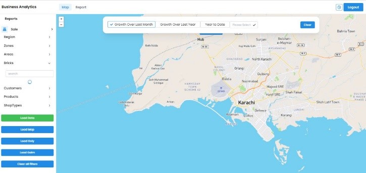
d. Capable of developing various other maps, such as ones listed below, based on data selected from filter panel.
• Bubble maps
• Choropleth map (GOLY, GOLM and YTD)
• Heat map
The product had an admin panel that was able to create, update or delete data.
a. The Admin Panel Administrator manages users and also have authoritative rights of modification and deletion of users and data.
b. User-friendly mobile application for data collection of all sales, surveys conducted by EE along with the complete data of payments transactions.
Description of Actual Services Provided by Our Staff within the Assignment:
This scope of the services may include:
• Implement WEB-based GIS system for sharing data / information and visualization.
• Rationalize and normalize data sets
• Develop territorial maps on GIS
• Connect those maps with their respective data sets,
• Format, integrate and upload all spatial data (bricks, territories, health centre locations, customer locations, doc visit’s locations etc.) and non-spatial data (sales, doctor profile, health centres visited) on web application.
• Conduct trail on operation of the system and get users’ feedback.
• Improve the system based on feedback.